Back to From the Highest Point: Landsurveys in the time of Mesdag
Close

Next step
Close

Vrij verkennen
Visit See and do Museum Shop Support us Donate Language
NL EN DE FR
Tickets
Press releases

Press

From the Highest Point: Landsurveys in the time of Mesdag

14.03.2019

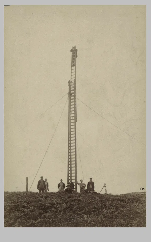
In 1880, while Mesdag was making sketches for his Panorama from the highest dune in Scheveningen, land surveyors were trekking across the entire country drawing up a map of the Netherlands. The painter and land surveyors alike sought out the highest points in the landscape: the first to create a spatial illusion and the latter to measure distances accurately. What similarities and differences were there in the approach of the artist and that of the surveyors? Thanks to a collaboration between Panorama Mesdag and TU Delft, this theme is explored and explained in an accessible way.
Read the entire press release

TU Delft Library is offering visitors a unique opportunity to come and admire its Special Collections outside the walls of the campus.

Contact FAQ Groups Accessibility Hire and receptions House rules Press and images

The Museum is open from Tuesday to Sunday, from 10am to 5pm

Instagram Facebook YouTube
Close
Tickets Visit See and do Museum Shop Support us Donate
NL EN DE FR

These cookies enables the website to work like it should. These cookies are not optional.

These non-anonymous cookies allow us to collect data about you, so we can measure the usage of the website and improve it accordingly.

These cookies are set by third parties, like YouTube or Vimeo.

These cookies allow our advertising partners (social media as well) to offer content tailormade for you.

When you disable categories, some functionality in the website might not work correctly. It's possible to change your preferences at any time. More information

To offer you the best experience we use cookies on our website.

More information Change preferences
Refuse cookies